Custom Maps For Event Safety
Custom Maps For Event Safety
Interactive maps are part of many useful applications we use every day. They are examples of maps created with “GIS”; Geographic Information Systems. GIS is designed to capture, store, manipulate, and manage all types of geographic detail. By overlaying information on street maps or satellite images, we can find the nearest pizza joint or the route to grandma’s house. New developments in this technology have significant implications for the special event industry.
What if we could look at a “live” map of a festival and see – in real time – crowd density, all service locations, current stage acts, and the locations of security teams and emergency medical responders? What if we could direct emergency responders to incidents based on nearest resource and receive a status report, image, and comment instantly? This and much more is currently available using custom mapping solutions.
Custom Maps for Special Events
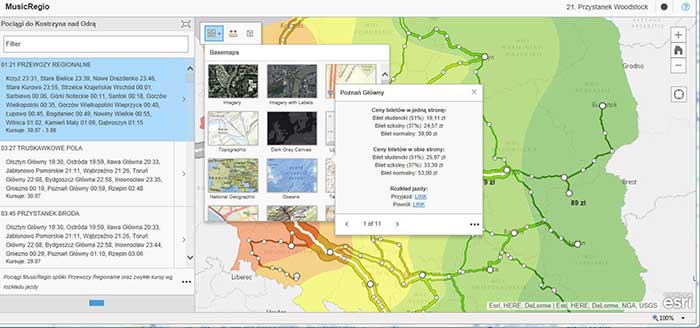
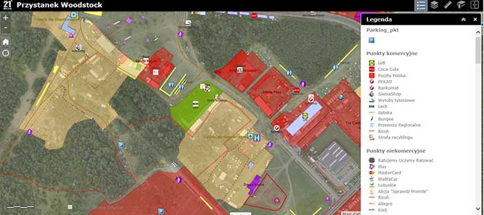
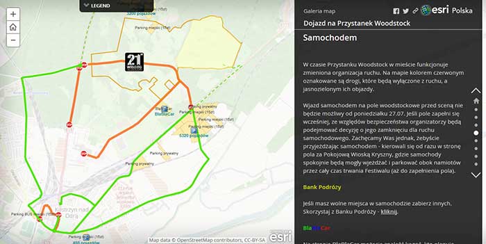
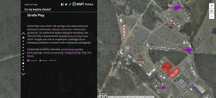
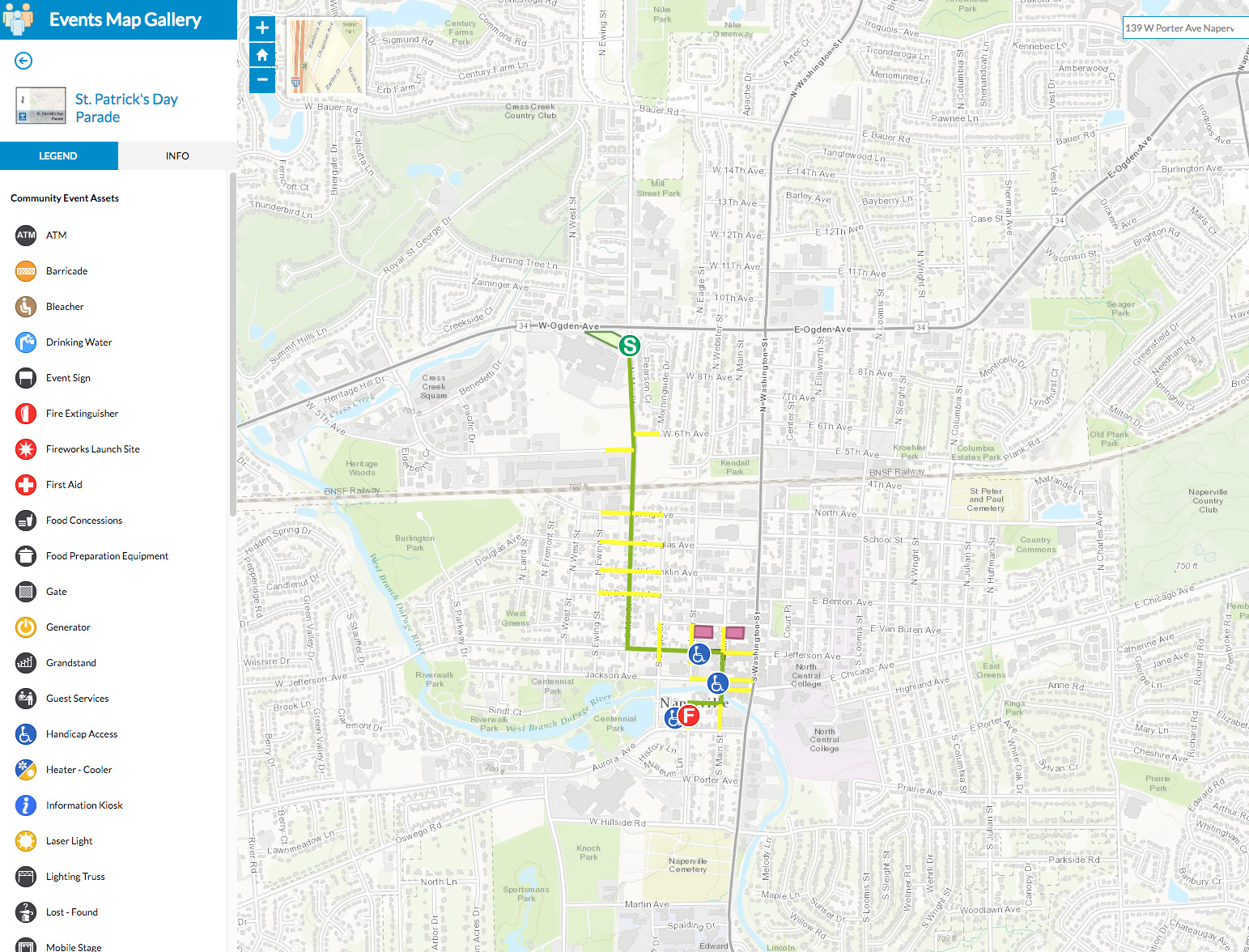
For special events, it in possible to make a custom map for a specific location, event, or festival. An event map can incorporate information for guests, producers, and emergency responders. Called mash-ups, these maps are like a cake with specific information on different layers. The bottom layer is the base map; stacked on top can be individual layers with facility details such as entrances, medical stations, concessions, stages. . . whatever is desired. All the information is geolocated, so it is geographically accurate to latitude and longitude.
These custom maps can be accessed with online or offline applications for smartphones, tablets or computers. While customers can see pop-ups with locations for restrooms or concessions, production center staff can see real-time locations for security crews, medical teams, and emergency responders. With GPS enabled radios we can immediately see staff locations and direct responders appropriately. And local agencies in an off-site command center can see the same information on their screens. This sharing ability with local responders can allow for proper allocation of assets and greatly improve incident response. Problems can be transmitted instantly from field workers and can show incident photos and notes. And the data can be rolling into incident report templates for after-event logging, saving hours of documentation.
ESRI and ArcGIS
ESRI is the leading provider of mapping services worldwide. With their mapping software, called ArcGIS Online, they have developed special applications for many industry applications and emergency responders. Recently they have introduced a suite of applications designed specifically for special events. The video below shows the use of their application developed for Fire and Emergency responders at a NASCAR race, but these features are also part of the Special Events application.
For the Special Events application, the maps can show site layout, road closures, set up times, pop-up images of locations, all selectable from a menu of icons. This active map shows a parade route. By clicking on the event map features, you can see relevant information. Virtually any feature can be added, searched, or viewed. Click on the map below to see samples on the ESRI site.
Special event maps can be integrated into websites and available to the public. Custom maps can be used for event production, security, medical, and local agencies. They can be “live” for last minute changes and real-time emergency response. Incident responses can be captured by time, image and text and then rolled directly into incident response report for post-event analysis. This only scratches the surface of how custom mapping solutions can make for more efficient, accessible, and safer special events.
Please contact Event Design Services for more information on using these maps for events.