Live Maps for Special Events

We are all familiar with maps on our smartphones or computers. These are very powerful applications that link together many layers of geographic information in accessible ways. These maps are built to meet specific needs and applications. For special events, it in possible to make a custom map for a specific location, event, or festival. An event map can incorporate information for guests, producers, and emergency responders.
Called mash-ups, these maps are like a cake with specific information on different layers. The bottom layer is the base map; stacked on top can be individual layers with facility details such as entrances, medical stations, concessions, stages. . . whatever is desired. All the information is geolocated, so it is geographically accurate to latitude and longitude.
Different views for different folks
These custom maps can be accessed with online or offline applications for smartphones, tablets or computers. While customers can see pop-ups with locations for restrooms or concessions, production center staff can see real-time locations for security crews, medical teams, and emergency responders. And local agencies in an off-site command center can see the same information on their screens. This sharing ability with local responders can allow for proper allocation of assets and greatly improve incident response. Problems can be transmitted instantly from field workers and can show incident photos and notes. And the data can be rolling into incident report templates for after-event logging, saving hours of documentation.
ESRI and ArcGIS
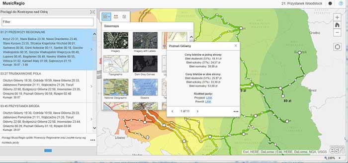
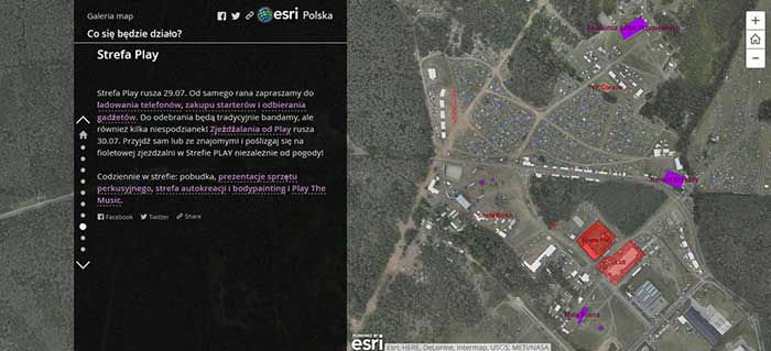
ESRI is the leading provider of mapping services worldwide. With their mapping software, called ArcGIS, they can create mash-ups and deliverable solutions for the special event industry. An example of how this can work was created for the Woodstock Festival Poland:
(The description below was produced by ESRI)
Do You Know the Way to Woodstock?
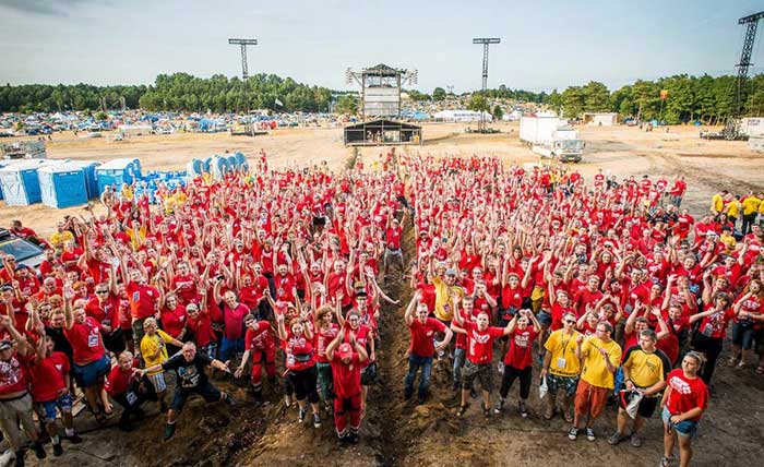
The Woodstock Festival Poland is a free music festival that attracts 750,000 concertgoers to western Poland. The festival has been running for two decades and takes place in a scenic outdoor environment at the end of July and beginning of August each year. The festival received the International Music Industry Award at the MUSEXPO 2015 in Los Angeles for the Best Festival Promoter. It is run by the Great Orchestra of Christmas Charity (GOCC) Foundation.
The festival is put on by 1,500 staff and volunteers who use mobile devices and online maps created by Esri Polska Sp. z o.o. using the ArcGIS® platform. These maps help the festival organizers plan and manage this weeklong event.
A total of 1,500 volunteers and staff used mobile mapping apps to keep the communication lines running smoothly.
To communicate information easily to those traveling to the concert, Esri Polska developed more than 20 interactive mapping applications for the festival. These applications not only helped 750,000 concertgoers get to the festival but also familiarize them with the venues.
Woodstock on Maps!
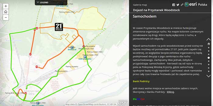
The gallery dedicated to festival participants consisted of four thematic maps that accompanied music fans during their travel and stay. An Access Map illustrated routes and contained guidelines on how to get to the site via train, bus, car, motorcycle, and by air. For a view of this in action, click HERE
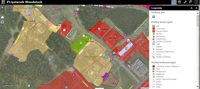
After reaching the destination, festival participants were able to use a detailed map that presented all the important places, including stages, camping areas, food courts, medical facilities, and parking areas.
Due to the expanse of the festival and the great number of concerts, participants could also access a story map displaying the location of all the stages with a detailed lineup of entertainment.
Safety First
Esri Polska developed applications and story maps to be used by festival participants as well as specialized maps for police, fire brigades, and medical emergency personnel. The maps provided coordination of all services to minimize response time to emergency events as well as to diminish their impact.
“Applications have been developed using the ArcGIS platform, namely ArcGIS Online, which allows for dissemination, sharing and publication of maps [on] the Internet,” said Robert Jędrzejczak, project coordinator at Esri Polska. “The organizers and services responsible for the safety of participants may immediately send and receive important information and coordinate all operations.”
Aerial photography flown by MGGP Aero right before the event created a timely orthophoto map that was easily understandable by the public. The images provided a unique ability to view the festival in almost real time.
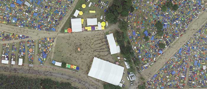
Recently flown aerial imagery gave concert strategists timely information they could use to run a smooth festival.
“The Woodstock Festival Poland is only the world’s second festival for which aerial photographs are acquired hours before the event starts,” Jędrzejczak said.
Coordination of operations and presentation of terrain information are not the only functionalities of mapping applications. They also allow for storing and analyzing data on events and operations, which help ensure higher safety levels for events.
“We are proud that within 21 years of the Woodstock Festival Poland being created, we have created a very professional way of training,” said Jurek Owsiak, president of the GOCC Foundation. “As a result, every year, several thousands of highly trained volunteers in the Peace Patrol effectively protect the largest and most beautiful festival in the world.”
Planning and executing concerts go more smoothly when staff and attendees know exactly what is happening and where. The ArcGIS platform provides better insight so event planners can create the best venue and most memorable experiences possible.
For more information on creating custom event maps, please contact Tom McClain at Event Design Services
0 Comments